Water, Weather & Environment
London smart city sensor network
The monitoring of surface water and SuDS (sustainable drainage system) to create a smart catchment area
Over the past two years, the London Borough Councils of Hillingdon and Croydon have identified areas of significant surface water flooding and have sought to innovate and improve their communities resilience by building their data resources, operational efficiency thus creating smarter catchment management.
- The challenge
- The solution
- The benefits
The challenge
The challenge
KISTERS have worked closely with Hillingdon and Croydon councils to identify
issues, which a smarter catchment could resolve:
- Improving communications between the different parties in order to share
useful secure data - Knowledge of surface water movement across the water network as a whole
- Tools that provide real time feedback to allow response to surface water
problems - Verifying where problems exist and identifying solutions that can mitigate
the issue as well as showing if the imposed solution/SuDS has worked
The solution
The solution
Finding a solution
The first step was creating an online platform that would enable parties to share data and form a comprehensive picture of surface water in and around London. The datasphere platform created by KISTERS and hosted in its secure data facility in Aachen provided that solution. Hillingdon and Croydon identified data gaps across their catchment where information could improve their understanding of the movement of the surface water. Sensors manufactured by HyQuest Solutions, a KISTERS subsidiary, were placed in key locations known to be problematic.
Implementation
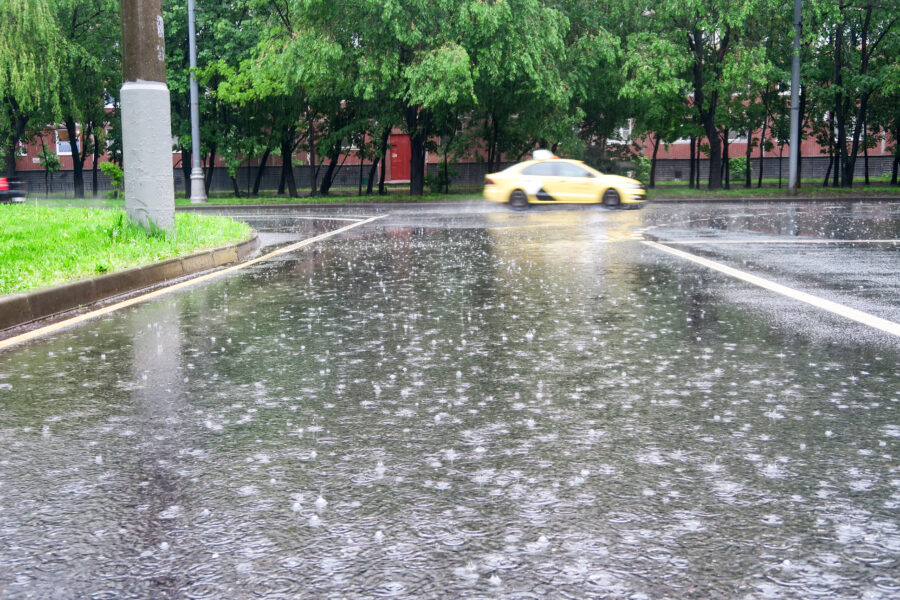
In Hillingdon a rain gauge (HyQuest Solutions TB6 RainTrack), a level sensor (HyQuest Solutions VHPS – vented hydrostatic pressure sensor), and a camera were installed to document the area’s response to rain and assess the effectiveness of an imposed sustainable drainage system (SuDS) scheme. In particular, the camera would indicate if a trash screen had become blocked preventing water from draining. In Croydon, three level sensors and a camera were added in problem areas that are constantly at risk of localized flash flooding. Two gauges were placed in culverts and one on the exit of an imposed SuDS scheme. The data was then ingested and visualized by KISTERS in the datasphere platform alongside free sensor data from the Environmental Agency. All data was archived for future use and an automated validation process was applied. Alarms were then set to trigger when it was assessed those levels could result in issues.
Results
Alarming functionality immediately identified the speed at which some sites could become inundated; the rate often leaves little or no time to react. This observation uncovered a new opportunity: increasing reaction time by using a smarter catchment approach. To quantify the most feasible reaction time and avoid flooding, the boroughs required highly reliable weather forecasts to post code level detail and thus a second KISTERS cloud solution was utilized in the form of HydroMaster. This further empowered Hillingdon and Croydon to be warned of heavy rain likely to cause issues in a more accurate and timely way.
Next steps
Although it is not a statutory duty for local authorities to provide surface water warnings, this is clearly an area missing on a local level from flood forecasting centre and the Environment Agency provision. So Croydon and Hillingdon are adding more sensors to build the network and improve their environmental decision making and develop this system. Other parties will be added as data providers to the platform to build up sensor data availability and develop a deeper understanding of the surface water flows around London and other parts of the UK, to enable smarter catchment management.
The benefits
The benefits
Collaboration of the London boroughs and KISTERS has
identified:
- Sharing data establishes a clear picture of the relationships between precipitation, sustainable urban drainage systems
(SuDS), and river and tributary levels. - Live monitoring and alarms enable faster proactive action to developing situations.
- The system helps getting the right person to the right place at the right time.
- A robust sensor network facilitates deeper evaluation of problem areas and causes, enhancing climate resilience with information and knowledgeable problem-solvers.